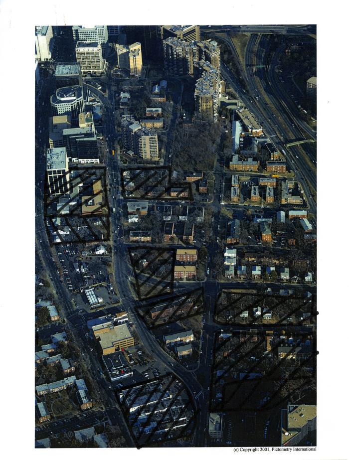
Aerial Photograph of Rosslyn with Handwritten Markings, 2002
(Image)
199-02-01-02-0002
2002
Aerial photograph printed on paper of Rosslyn showing 16th Street N and Clarendon Boulevard, with Wilson Boulevard on the left, US Route 50 in upper right, and N Nash Street at top. Buildings are crossed out by hand in relation to Rosslyn affordable housing and amending the boundaries of the "Rosslyn Coordinated Redevelopment District," 2002.
1 photograph : color print
This image is subject to copyright. Unauthorized use of the images in the Local History Photograph Collections of the Arlington Community Archives is prohibited.