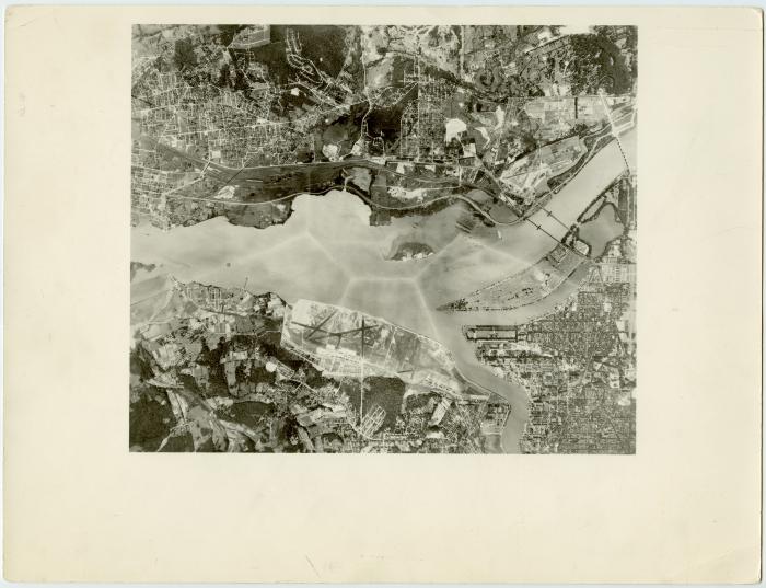
Bolling Field and Anacostia Naval Air Station
(Image)
Part of
RG 13: Samuel Milner National Airport Research Papers ; RG 13: Samuel Milner National Airport Research Papers » Series 6: Photographs » File 3: National Airport*13-06-03-5083
1930s
Very high aerial view of the area that would soon include Washington National Airport. Bolling Field and Anacostia Naval Air Station can be seen on the right with Gravelly Point just across the Potomac from it.
1 photograph : b&w print ; 8 x 10 in.
This image is subject to copyright. Unauthorized use of the images in the Arlington Community Archives is prohibited.